A Paddler’s Journey – Ron Sell’s 2013 River Expedition
A little over 20 years ago, Joan Martin (Huron River Watershed Council Adopt-A-Stream emeritus) had the wonderful idea of getting a bunch of people together and paddling the whole length of the Huron River. After a year of planning, getting dozens of people involved and communities on board, Joan’s idea grew into RIVERFEST, a nine day celebration of the river from start to finish. The expedition was fun, enlightening and a great experience for all – forming bonds and networks that continue today.
It seemed like time to do the trip again, to see what has changed over 20 years. Armed with HRWC’s new Paddler’s Companion guide book, we could see how close we have come to making a true water trail. We would do it in 5 days without the fanfare or agenda, just for fun and adventure.
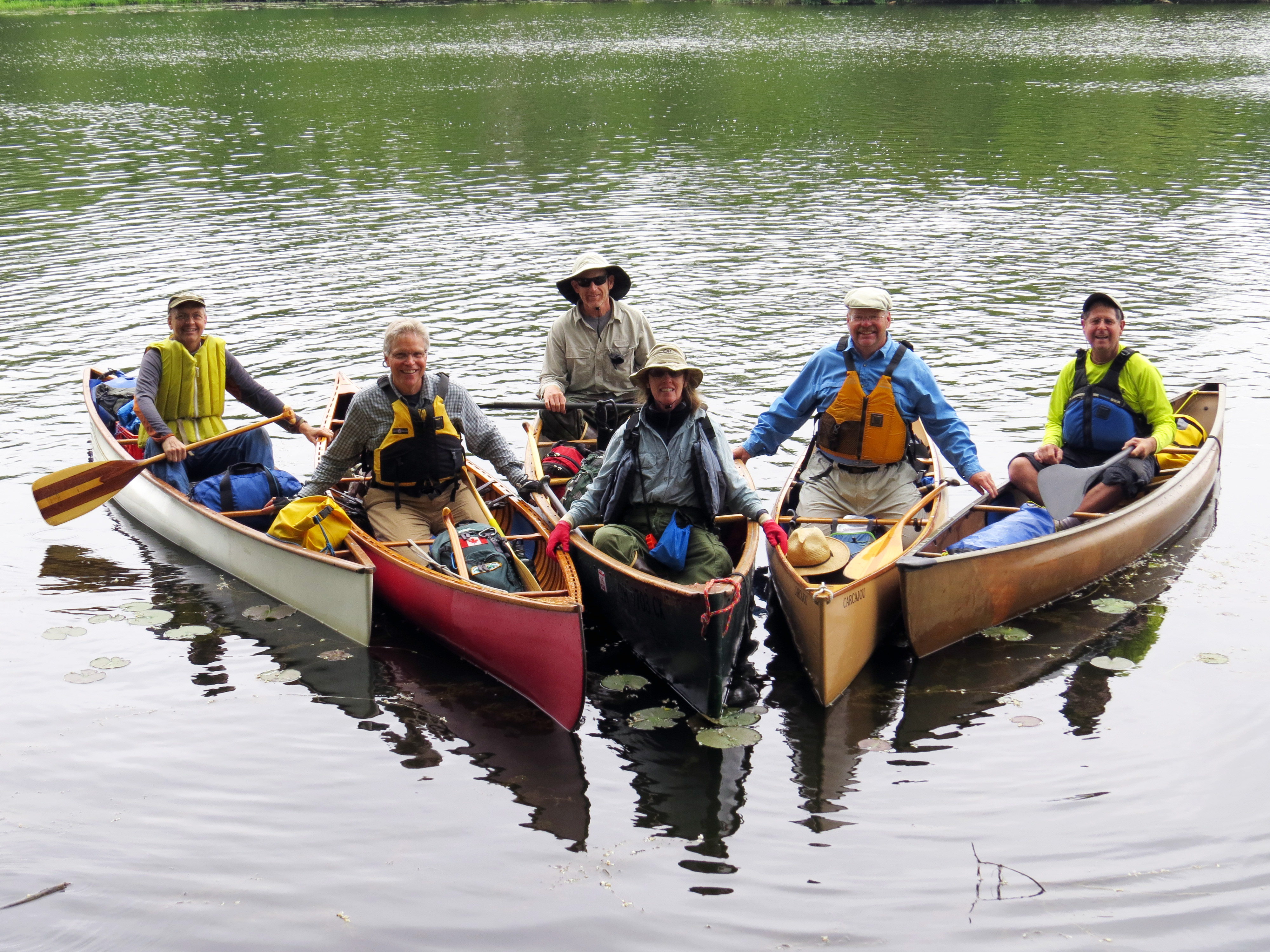
For this trip, we were a small and select group of paddlers. Paul and Joanne Lang from Ohio, Marty Cooperman from Cleveland, Steve Gilzow of Saline, and Paul Seelbach of Chelsea made up our merry band.
Day 1: Proud Lake to Island Lake Canoe Camp
14.63 mi
4 hrs 29 min paddling
2 portages
Beautiful weather, lots of birds and fishes. Light tail wind makes the 3 mile crossing of Kent Lake a breeze. Two easy portages, nice clean water after the Kent Lake Dam. Canoe camp is very pleasant and secluded. Peaceful camping overnight, but no drinking water available on site.
Day 2: Island Lake Camp to Hudson Mills
22.75 mi
6.5 hrs paddling
1 portage
8am start on the water through one of the nicest stretches of the river. A very pleasant paddle, dodging fallen trees. First, lunch at Huron Meadows, then on to the lakes.
Good paddling karma gives us light breezes across Strawberry, Whitewood and Gallagher Lakes and gets us to Base Line Lake. We stop for second lunch at the University of Michigan Sailing Club. Paul explains how we are leaving the first phase of the river – upland wetland woodland – and entering the section that works its way through the rocky, gravelly glacial moraines.
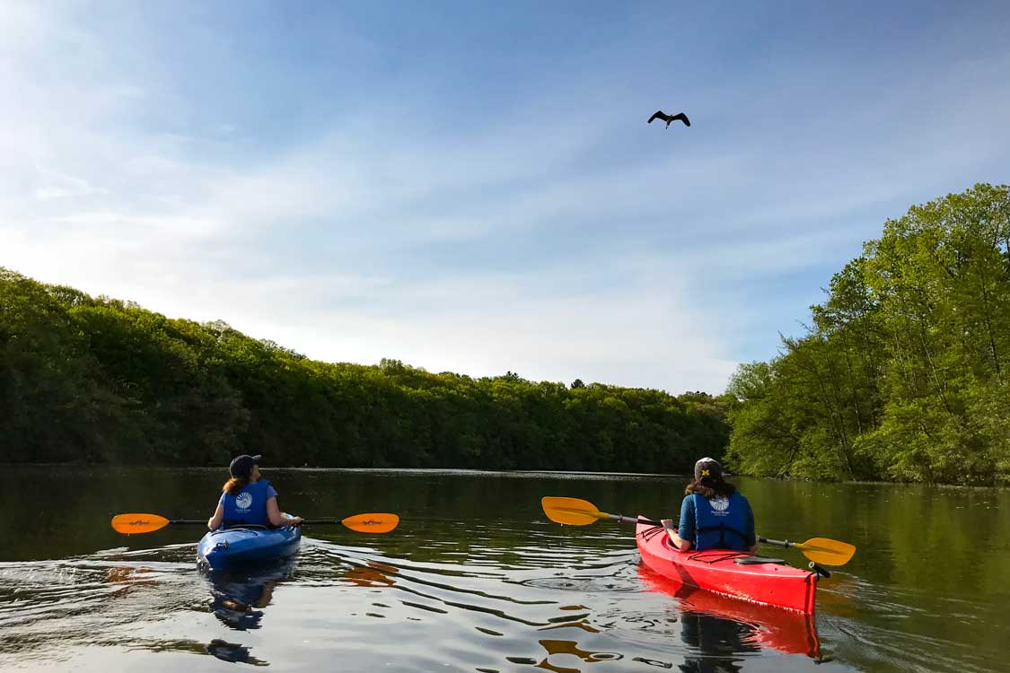
Mink, muskrat, great blue heron, orioles, catbirds, kingfishers, killdeer, cygnets riding on the back of a swan, owl (barred?), pileated woodpecker. Signs of beaver below Base Line Lake. The eagle that has been hanging out around Bell Road was absent today.
Many carp splashing, suckers along the bottom and small mouth bass. A fisherman at the rapids at Hudson Mills reported catching (and releasing) 27 this day.
Day 3: Hudson Mills to Superior Pond
22.7 miles
6.5 hrs paddling
4 portages
On the water before 8am. Up close and personal look at the tornado damage from March 15, 2012. Some impressive “tornado art” just above Mill Creek. Great blue herons escorting us all the way down the river. Several of us elect to run Delhi Rapids; the rest choose to portage.
I forget how nice the stretch below Delhi is to paddle. Often overlooked, this stretch is mostly natural, high banks on the south and strong, steady current. The drop at the old Osborn Mills site adds some excitement.
Our good paddling karma continues with a tailwind across Barton Pond; two egrets and an osprey inspire us on. Quick stop at the NEW Center to salute the Huron River Watershed Council staff, then on to lunch at the Argo Livery before tackling the Cascades. Be sure to stop and enjoy the Ned Sharples bench in front of the livery–he inspired many of us to paddle, enjoy and protect the river. We run the Cascades with empty boats without incident but all dragged our sterns on the rock on the last drop.
Past the UM Hospital, through the Arboretum and an easy run across Gallup Pond and quick portage over the Geddes Dam put us in Superior Pond. We discuss the history of this forgotten and peaceful stretch of river and end the day at a secret campsite we’ve nicknamed “Superior Bluffs – a gated community”. Laura Rubin joins us for a few hours. We have a lively and very informative discussion on a wide variety of topics, all river-related. Peaceful night, no bugs.
Day 4: Superior Pond to Lower Huron Metropark
16 miles
4.5 hours paddling
3 portages
Up early again and on the water by 8am, a short paddle to our first portage– Peninsula Dam. This portage is pretty straight-forward and fairly easy, but lack of maintenance has led to deterioration of the landings, making it harder than it should be. Back on the water and a fairly fast ride through Ypsilanti. We all remark on the waterfront potential of this town and can envision an active vibrant face to the river with the restaurants, shops and boardwalks.
On to Ford Lake, our weather karma continues with cool temps, overcast skies and no wind – perfect paddling conditions. Here we leave the second phase of the river, leaving behind the glacial moraine features and enter the glacial lake bottom evidenced by the high clay or gravel banks that the river has cut through on its way to present day Lake Erie. Portaging the Ford Lake Dam takes some effort and teamwork of the group but we are soon back on the water headed for Belleville, stopping for lunch at Van Buren Park where Willow Run enters the river.
We eventually arrive at French Landing, tired but not beat. The portage here is difficult, if not impossible, so we use the backup plan – Kay is called in and helps us with a car shuttle into Lower Huron Metropark.
A short paddle brings us to the canoe camp. We are all excited by a visitor, an all-white bird that flits and perches around the campground, causing much speculation. We determine it is a white phase (leucistic) kingbird, something none of us has ever seen.
Day 5: Lower Huron Metropark to Lake Erie
27 miles
6.5 hrs paddling
1 portage
After another quiet and peaceful night camping, we’re up early for an 8 am start. Mike George arrives to accompany us as far as Oakwoods Metropark, and Jim Pershing, Superintendent for the Park, shows up to bid us a Bon Voyage.
This next stretch is perhaps the best kept secret of the whole river. It’s surprisingly remote and mostly natural with few houses or intrusions; the only negative is the constant noise of jet traffic overhead (choose a day with north winds if you can when paddling this stretch, as the jets will be taking off in the other direction). Herons, kingfishers and orioles escort us along the banks. Sycamores, catalpas and redbuds provide the greenery. Future Water Trail mile markers and sign posts will be a welcome addition as landmarks are few and far between. Highway and railroad bridges are soon passed and we enter the backwaters of the Flat Rock impoundment and Oakwoods Metropark, a wonderful stretch of oxbows and bayous.
Our weather karma wanes a little, as the east wind gets funneled down the lake giving us a stiff headwind for the crossing. Mike George waves goodbye and heads for the Nature Center, and we set our sights on the right end of the Flat Rock Dam anticipating the portage and lunch stop ahead. Flat Rock Metals has graciously left the gate unlocked so the portage is surprisingly quick and easy; we move our gear to the bank below the low dam by the covered bridge and enjoy our well-deserved lunch. Ten miles to go.
The current helps us along for the next few miles and the woods gradually give way to more open marsh and wetlands. A few more houses along the banks with some impressive metal breakwalls, and soon the Jefferson St bridge is in view. We pause to collect the group and marvel at the remains of the circa 1800 plank road built from the War of 1812, known as Hull’s Trace, visible along the shoreline, and ready ourselves for the last push across the river mouth to Pt. Mouillée. Kay, Klaus and Aileen are there to greet us with our shuttle vehicles awaiting in the parking lot.
Epilogue:
Total river miles: 101.8
Total hours paddling: 28 Total portages: 11
What a great adventure. I couldn’t have asked for better paddling companions and our shore support was wonderful. Thanks to all who made this adventure truly special: Laura Rubin and Elizabeth Riggs for help with logistics, Klaus Wolter who helped shuttle cars, and especially Kay Stremler who fed us a feast at the end of Day 2, shuttled cars and provided the motorized portage to Lower Huron.
We started this trip asking what has changed along the river since we last paddled the length with the 1993 Riverfest.
First, the good news – not much has changed. No big developments, no horrible intrusions. Parklands that dominate the shorelines are intact and mostly natural. Water quality appeared to be good and a wide variety of wildlife greeted us along the banks. Many people were enjoying the water, whether paddling, rowing, walking or biking along trails, bank fishing or just relaxing.
Now the bad news – not much has changed. Although there are adequate access sites up and down the river, usable, safe landings and proper portage trails remain few and far between. A notable exception is the Superior Dam portage, a well-designed trail that is a huge improvement over the jungle that used to be there. Yet the Peninsular Portage has deteriorated badly, French Landing can’t be portaged safely, and you still have to make special arrangements to get around Flat Rock. Landings at well-used sites such as the Kent Lake Dam, Island Lake, Hudson Mills, and Ford Lake are either haphazard riprap or muddy eroded banks. Campsites are few and far between– currently there are five riverside campgrounds and none at some strategic distances making a trip of more than a few days difficult.
Would I recommend paddling the entire length of the Huron? Of course – there is a special thrill of paddling a river from a small trout stream all the way to open water. But I suggest that the less adventurous break the trip up over two weekends – first, Proud Lake to Ypsilanti; and then the Lower Huron to Lake Erie – which would avoid many of the present pitfalls and encounters with motorboats. Of course, the river can be experienced through a series of daytrips, as well. The new HRWC Paddler’s Companion and ongoing work to build a Water Trail will only make the experience better in the future. What a great resource we have right in our own backyard
To paraphrase our State Motto: If you seek a pleasant river, look about you . . .
– Ron Sell, Paddler and Owner of Unadilla Boatworks
Original Article: Huron River Report Fall 2013